If you're like me you've had no training at all in Latin and so I'll just say right out that the name for this blog is the State Motto for Oregon. Translated, it says, "She Flies With Her Own Wings". Which is what we did today. We got out and we traveled under our own power and had an exceptional day. And, as fate would have it, the motto has its own fun origin.
Fun Facts: The motto was suggested by Judge Jesse Quinn Thornton and added to the Territorial Seal adopted by Oregon Territory in 1854. It referred to the 1843 vote by Oregon settlers to form a provisional government independent of the U.S. and Great Britain.
During the Civil War, the motto on the state seal was changed to 'The Union.' In 1957, the Oregon Legislature officially changed the motto to 'The Union' regulating conflicting views about slavery in Oregon's early days. In 1987, the legislature readopted the original motto, which it felt better reflected Oregon's independent spirit.
And Oregon does have an independent spirit. Oregonians take special pleasure in celebrating their uniqueness. They tend to, at times, even push it in your face.
And, y'know, Oregon is unique. At least along its coastline it is. And today we decided to go ahead and drive along that coast up to Fort Stevens, near Astoria along the Columbia River, riding The 101.

But, as we all know, any successful, and fun, trip requires the necessary provisions. And where better to outfit ourselves with all our essentials than at the local Dollar Tree.
Hahahaha, cookies and coke.

Now we're ready to go. Heading up The 101 and lookin' for adventure.

The weather called for fog in the morning and then some sun, a rare treat, in the afternoon.
Just to see how much fog we had, we pulled over at the first scenic viewpoint you come to after you leave LCO. It's the first one you come to going north. It overlooks Dalay Lake and, just to the right in this picture, Camp Wi-Ne-Ma. The fog was still there, hanging in over the ocean.

But, standing there, we were able to enjoy the wildflowers if not the ocean views.

And some more Oxeyes. Or English Daisies. I guess I trend towards them cuz, well, daisies are one of my favorite flowers.

These foxgloves would cost a pretty penny in any nursery. But they're all over the place here in Oregon.

Like the fog was today.

But not everywhere.
I know I've mentioned it before, but I have yet to get tired of driving The 101. The view just keeps changing and it never gets boring. Plus, I never have to go faster than 55.
Just my speed.

Because we had nothing else to do except enjoy ourselves, we stopped at the next viewpoint, too. The fog was moving back onto the ocean. The weather said it was suppose to be sunny in the afternoon but although we saw plenty of sunshine, there was still fog throughout the day.
Crazy Oregon weather.

Remember, we talked about Oregon's uniqueness, before? Kinda reminds me of Seattle's alley walls and signboards. Unique.
Ah, those silly kids. Stickers, the graffiti spray paint for well-to-do yuppie hipsters.

And us. Hahahaha, I've got on my Carl's Jr. cap from Kuwait. Always a winner.
One of the first days when I haven't needed a jacket or sweater to go out.

Seriously, anytime we want, we just drive for a little while and then we get views like this.
We stopped at the scenic viewpoint just outside Manzanita.

And just before this place. Which, conveniently and most importantly, had a restroom. Hahaha, remember the DCs I bought at the Dollar Tree? Yeah, so did I.
An interesting lot, it was, as much as it was, full of young kids with surfboards, eating lunch. Young, skinny and obviously healthy show-offs. Eating carrots and the other healthy stuff. Hahahah, jealous much?

And then they headed down this trail to the Short Sand Beach Creek.
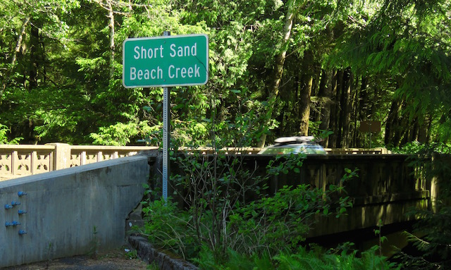
A path leading down and under the bridge carrying The 101 over the Short Sand Beach Creek. Whew, that's a bit much for a name of a creek, isn't it?
I looked but couldn't find any reason for the rather odd name. Short Sand Beach was known as Smuggler's Cove for a while although there's no evidence it was ever used for smuggling. Which, you know, might be a prerequisite for having that kind of a name.

And here's the infamous creek. I'm not going to do that name again if I can help it. But it was lovely. For a guy who grew up in L.A. and the only rivers I saw as a kid were all made of concrete, this is a kick in the pants.

We took the half-mile walk down to the beach and the walk alone was more than worth it.

The initial trails in this park were laid out by the CCC between 1939 and 1941.
The park that Short Sands Beach is in is the Oswald West State Park.
Fun Facts: The land for this park was gotten between 1931 and 1976. It was once named Short Sand Beach but was renamed Oswald West State Park in 1958. Oswald was the former Governor of Oregon from 1911 to 1915. He was a man ahead of his time for he caused nearly 400 miles of Oregon shoreline to be set aside for public use.
Way to go, Os!!

This path and the others they have here, take you through one of the best preserved coastal rainforests in Oregon. Low-growing ferns, salal and salmonberry are shaded by massive western red cedar, western hemlock and Sitka Spruce trees that form the basis of the temperate coastal rainforest ecosystem of the Great American Pacific Northwest.

Next time I think I'll go to the left.


Uh, wow.

And I kept getting lapped by all these young surfers. Only because I was stopping so frequently to take pictures. Yeah, that's the reason.
Show-offs.
Didn't surfboards used to weigh a lot more? I mean, these guys, and girls, were just tossing them around like they were made of balsa wood.
Show-offs.

There was a lot to see and I hadn't even gotten to the beach yet.

But I was getting close. I could hear the roar of the ocean through the trees.

Yep, I was getting close.

And yet another show-off lapped me. But, honest, I wasn't minding it that much. This was a walk designed to be taken at a leisurely pace; so as to be enjoyed completely.

Fun Facts: This was once a camping park. But in 2008, an 11-foot diameter (That's pretty damn big!!) spruce fell without warning. It fell across a couple of campsites but, fortunately, no one was injured.
They closed the park to camping temporarily and then, in 2009, after some debate, they closed it for good because of all the aging and dying trees in the area. Bummer.

Hahaha, they're big but I don't think they're 11-feet in diameter.

A woodpecker tree.

Smuggler's Cove, except now it is known as Short Sand Beach. Still haven't found anything to help me understand how they came to this name, Short Sand. But it's in the Oswald West State Park!! And they even have wagons to help you truck your stuff in. How nice.
It's too small for you to see, but, trust me, there's a bunch of those young show-offs out there in the ocean hanging ten and shooting the curl.


If you squint and look real hard, you can see Carol down there hunting for treasure. She's the little dot just to left of center in the picture. The speck next to the Short Sand Beach Creek as it runs along into the ocean.
Hahaha, Dora the Explorer!!

Everybody's gone surfin', Surfin' USA.
Even when I was younger I thought this was a stupid way to spend a day at the beach.

Hmmmm, I wonder how sturdy this one is?


It's fun looking up, and looking down. Some salal on the left, and then some False Lily-of-the-Valley. Oh, and some Oxeyes.

A lot of photo opportunities.


An ordinary leaf with some back-lighting.
It's fun, looking with a photographer's eye. You get to see more than you normally do. Everyone should try it. When you get into the habit, you tend to enjoy things more.

Hahaha, it's easier for me to look down when I'm walking. I fall over less than when I'm looking up.
Hahaha, all grace and two left feet.

Soon we were back on the road, and in and out of the fog. I tell you I really like driving The 101. I never thought of all the photo opportunities there are on the open road.

Who could get bored driving down these roads. Seriously, who could!?! Not me. And I putt along at my 55 and get to wave back at all the people who wave at me as they speed past me. This road must make people more sociable.
Except they mostly aren't smiling. Hmmmm, wonder why?

After the park, we motored on up to Fort Stevens. We've been there, briefly, once before when we visited Astoria last year. It was built as part of the Coastal Artillery defending America's shores.
They've opened the beaches on the peninsula and now they have some campgrounds out there. Not too crowded for this first weekend after school has let out. It's like each beach has its own personality personified by the sand. Like this beach. The sand was small and dirty looking. It was difficult to walk through being so fine and loose.

They even have their own shipwreck here.
In 1906, the crew of the sailing ship Peter Iredale took refuge at Fort Stevens after she ran aground on the Clapsop Spit. The wreck is visible today on the beach.
They tried to right her and get her back to sea but bad weather prevented them. After several months the owners gave up and the ship was sold as scrap.

The Peter Iredale shortly after she ran aground.
 |
| Internet |
And, of course, you can drive on the beach. That's one of the things that strike me as odd about Oregon. They're all, for the most part, a bunch of touchy-feely, kumbaya-singing tree-huggers and yet they let you drive your big, gas-guzzling and pollution-emitting trucks and cars out onto the beach.
Craziness. I mean, I have no problem with it as long as they don't bother me, but it still strikes me as incongruous.

Carol went out looking for some treasures. She found a bunch of dead crabs. Not much else. You can see a couple of them just behind her.

Dunes. I like the contrast between the brown, green and blue.

The old shipwreck is very popular.


And we found this!! How convenient for us.

And we were off.

To the bunker. Unfortunately, the grass in front of it was so over-grown we couldn't really see anything. So we walked out and down the path. Also unfortunate, was that we didn't see anything of interest while we were there other than some gulls.
As you already know, there's never an end to the gulls.

And got a much better view.

Of the bay.
Seriously, it was all there and we just had to enjoy it. Hahaha, I'm liking it.

This small estuary sits just to the south side of the Columbia River as it flows into the Pacific Ocean. Hahaha, I know, I'm a huge name-dropper.

And then we walked over to the other side of the peninsula. There's the mighty Columbia as it flows steadily into the Pacific.
Across the river is the great State of Washington.

And we got to see a Caspian Tern and ...

... a Glaucous Gull.
The fun never ends when you're with me!! Never!!

And Carol is posing with the Columbia. Just beyond that spit of land behind Carol is the Pacific. Except for the doggone wind, it'd be a great place to have a picnic and spend the day at the beach.

Ay, what a beautiful day it was.

Back in the day, a railroad ran out on this pier to unload ships for the fort. Now all that is left are the pilings.

I wanted to head back and take a second, closer, look at the old fort. And because I knew it was a part of the Coastal Artillery, I figured part of it would overlook the Pacific. So, we drove to the very end of the peninsula.
Then we came back to Fort Stevens.
Fun Facts: The fort was named for Issac I. Stevens. A staunch supporter of Franklin Pierce's candidacy for President, he was named the first governor of the newly created Washington Territory in 1853. And he was also awarded the contract to survey a route for a railroad across the northern U.S. Who says politics doesn't pay?
Stevens was a controversial governor in the way he treated the Native American tribes. He forced them to sign treaties ceding most of their lands and rights to the government. He also used the military to quash any resistance. Stevens was, however, popular with the good folks coming into the Territory as he was viewed as being very pro-settler (Duh!) and, as a result, he was elected the territory's delegate to the U.S. Congress in 1857.
He was a colorful man. Born in Massachusetts, he left home for West Point and graduated from there in 1839 at the top of his class. He served for a number of years with the Army Corps of Engineers. He was the adjutant of the Corps of Engineers during the Mexican-America War, seeing action at Vera Cruz, Cerro Gordo, Contreras and Churubusco. For his bravery during these battles, he was breveted to the rank of Captain. He was again cited and breveted for gallantry at the Battle of Chapultepec, this time to Major.
When the Civil War began in 1861, Stevens was commissioned in the Army again. This time he was a Colonel of the 79th New York Volunteers, known as the Cameron Highlanders. He became a Brigadier General in September of '61 and led a division at the Battle of Secessionville, where he personally led an attack on Fort Lamar, losing 25% of his men.
Transferred with his IX Corps division to Virginia, he was killed in action at the Battle of Chantilly in September of '62, after picking up the fallen regimental colors of his old regiment and shouting 'Highlanders, my Highlanders, follow your general!!' Charging with his troops while carrying the banner of Saint Andrew's Cross, Stevens was struck in the temple by a bullet and died instantly.

More Fun Facts: Fort Stevens was once the primary military defense installation in the three-fort, Harbor Defense System at the mouth of the Columbia River. Forts Canby and Columbia in Washington were the other two.
The fort was in service for 84 years, beginning during the Civl War and closing at the end of WWII. Today, Fort Stevens has grown into a 4,200 acre park.

I kept seeing scenes from An Officer and A Gentleman as I was walking around the old battery. Y'Know, Mayo and the Gunny squaring off.

More Fun Facts: Battery Russell was constructed between 1903 and 1904 for the U.S. Army Coast Artillery Corps. It was one of nine concrete gun batteries (emplacements for cannon or heavy artillery) built at Fort Stevens to conceal and protect mounted guns from enemy ships.

More Fun Facts: Battery Russell was named for Brigadier General David A. Russell, who served with the U.S. Infantry Regiment in the Oregon Territory and commanded Fort Yamhill before he was killed in action during the Civil War.
Below is Gun Pit #1.

Even More Fun Facts: Battery Russell was built separate from the other gun batteries at Fort Stevens clustered along the banks of the Columbia River. It faced the ocean to the south, expanding the network of artillery and the triangle of fire.
It was armed with two 10-inch disappearing guns whose barrels could retract from view into the gun pits to provide cover for soldiers while they reloaded. Each gun was manned by a team of 35 men. A well-trained gun crew could fire a 600-pound shell once every minute with an effective range of eight miles.
Uh, wow!

An interesting photo of the gun crew posing with their gun.
 |
| Internet |
War comes to America.
Fun (?) Facts: At about 11:30 p.m. on the night of June 21, 1942, an imperial Japanese Navy submarine bypassed the entrance of the Columbia River. It was the I-25, a member of the I-class of long-range submarines dispatched to go after military targets and navel vessels along the western coast of the U.S. The sub surfaced just south of Fort Stevens about 10 miles offshore and began firing shells from its 5.5-inch deck gun in the direction of the fort.

Soldiers scrambled out of bed and raced to their posts. They located the submarine by its gun flashes, but were told to hold their fire. It's unclear why that order was given - perhaps they felt the sub was beyond the reach of their guns. Possibly the harbor defense commander may have wanted to avoid revealing the precise location of the fort and the extent of its arsenal. It's also possible there was a conflict between the newly federalized artillery regiment and the OIC may have played a factor. Ah, male egos. They're terrible things at times.

Regardless, the fort did not return fire.
Fortunately, most of the I-25's shells landed harmlessly in isolated swamp and beach areas, although several did touch down near Battery Russell.
 |
| U.S. Troops examine a bomb crater after the attack, June 22, 1942. |
A regional newspaper at the time said that the sub 'peppered the Fort Stevens area...for approximately sixteen minutes' before it ceased firing, submerged and retreated beneath the waves.

The attack by the I-25 may have been in retaliation for 'the Doolittle Raid,' a surprise attack on the Japanese home islands by American B-25 bombers two months earlier.
All told, approximately seventeen shells were fired at Fort Stevens. Although there were no casualties and the shelling caused minimal damage to property, it did cause some concern about the threat of future attacks.

With this attack, Fort Stevens saw its only wartime action. It also became a historical footnote as Fort Stevens became the first U.S. mainland military base to be fired upon by a foreign power since the War of 1812 - at the time of the attack, a period of 130 years. Fortunately, it still holds that distinction.
As for the I-25, it went on to sink two U.S. freighters and launch aerial bombings of forested land in southern Oregon near Brookings. It was destroyed in 1943 in the South Pacific by a U.S. warship.
And now the fort has more flowers than soldiers.


Thank heavens.

After we visited the Battery, we went on over to the main post to visit the Fort Stevens Museum.

Here's a once-Confidential map of the Harbor Defences of the Columbia.
It's easy to forget the fear, and small bit of hysteria, that took hold of the Nation back in the first year of the war.

It's interesting seeing the enormity of this fort. You don't get the sense of the size just walking around the open grounds today.

A model of the guns at Fort Stevens.

Part of the gun crew. He plotted distance and trajectory for the big guns.

I had not realized it, but it does make sense. They mined the entrance to the Columbia River during the war.

A display of the uniforms and weapons from the First World War.

In spite of their lethal intent, there is a beauty to these weapons.


And the uniforms and one of the weapons from the Second World War.

The men who served at the fort during WWII.
You could say that these men sorta won the lottery when you contrast their duty here at Fort Stevens with that of the men who went overseas and served in either the European or Pacific Theaters.
But, as Milton said, they also serve who only stand and wait.

It is a nice museum. Although the gift shop at the lighthouses have been bigger.


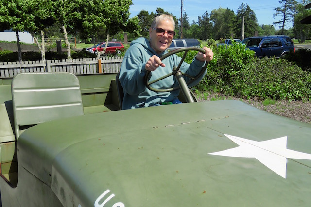
Who wouldn't want one of these now?
The famous Jeep of WWII.
Fun Facts: Although most likely due to a bastardization of the acronym 'GP' used to designate the vehicle, another likely factor in the popularization of the jeep name came from the fact that the vehicle made quite an impression on soldiers at the time, so much so that they informally named it after Eugene the Jeep, a character in the Popeye comic strip and cartoons created by E.C. Seagate as early as mid-March, 1936. Eugene the Jeep was Popeye's 'jungle pet' and was 'small, able to move between dimensions and could solve seemingly impossible problems.'
The official name for this mechanical wonder was U.S. Army Truck, 1/4 Ton, 4x4.
Obviously not as cool as naming it after a cartoon character.

See what I mean!?! No one can resist them.
A long shot of Battery 245.

If you have a bunch of soldiers well, then, you're gonna need a guardhouse.

And its gotta be secure. And this one gave every appearance of being very, very secure.

There is a beauty to these old buildings on military posts. A martial simplicity colors every military installation built before WWII. An honest beauty with an eye always towards utility as well as military discipline and order.
Even in the guardhouses.

The Officer of the Day worked in the back office while the Sergeant of the Guard held sway in the front.
Hahaha, clipboards on the wall, always a hallmark of a military office.
Kids today would probably recognize the handcuffs on the wall but wouldn't have an idea what the two black things are on the desk to the right. Oh, and, yeah, that's an ashtray there on the desk to the left. Very authentic. Nice touch having some ashes and cigarette butts in there.

Look closely at the floor immediately in front of the dutch door leading to the Sergeant of the Guard's Office. See how worn down it is?
All the members of the guard would report to the Sergeant at this door and, once they'd received their assignment, they'd come to attention, execute a smart right-face and step out. And in doing so, they wore down this one spot on the floor.

During the 50s, the Air Force had a small radar unit assigned here. They didn't have a dispensary so they built in some walls and put in a small one here in the guardhouse.

The break room for the guards.

The beds were hot racked. In other words, the members of the guard, on duty for just a day or two, would share their cots, one man sleeping while the other was on duty and then switching off.

The barracks part of the guardhouse. The footlockers look a bit more secure than the ones I had in the Marines. When I first joined, the mattresses and pillows were all made by prisoners. Not necessarily military, though. The mattresses were maybe 4 or so inches thick and easy to roll up.


The washroom for the guards. We were told there were no showers here because the guards would rotate out before they needed one.

And then we went back to see how the prisoners lived. The jail was divided into three parts. The forward two parts were for general population and there was another area for isolation.
Life in the guardhouse was deliberately difficult. The soldiers here had to request permission to be let out to use the latrine, do their laundry, shower or get a drink of water. The jail would be empty during the day as the offenders would be taken out across the post and put on a detail doing some dirty job that needed to be done or just breaking stones.

They were observed in everything they did.

On the right are the tubs where they did their laundry. Then they'd hang their clothes up near the heaters to dry.

Fortunately, most soldiers were in here for a short time only.

Then we went back to the isolation cells. These were the real bad boys. In the last cell they saved some of the graffiti written on the wall, in pencil. The men who were here could't talk to anyone. When they were taken to the latrine, the other prisoners had to face the wall so that no one would see him other than the guards. No one was allowed to talk to them.
Rough duty. Yet, the guide told us that the graffiti was written by one soldier who was in isolation on three separate occasions. He must have been a joy to have in your unit.

This is the entry way where they brought in all the prisoners. Just outside is my faithful Mini.

From the Fort Stevens guardhouse, we headed back home. It'd been a pretty full day so far but we still had some time for fun.
It'd been in the back of mind that there was another lighthouse somewhere up north and I was hoping we'd get a chance to see it. I knew it was out on a rock about a mile off the coast, but that's all I knew.
I didn't see any signs for it, though. Nothing to indicate where it was. So, just because I'd seen it on the Google Map last night, I thought we'd go ahead and stop at Ecola State Park.
Just getting to the parking lot was a treat. We had to drive through some very scenic forest for about a mile and a half just to get to the parking lot.
And the view from the lot was worth it, too. Looking south down the coast.

Looking west towards the ocean. Gives you an idea of the kind of day it was. Notice the fog? It's just moved off-shore a mile or so.

Some of the basalt rock formations so common along the Oregon coast.

You're never far from trees along the coast.

The path used to continue on beyond the restrooms. They had some erosion problems this past winter and had to shut the trail down that led to the overlook.

Still, you could get some good views.

It's funny how the cloud banks just stand off shore. This happens alot from the little I've seen.

It was a great day.

I don't suppose that they get a lot of surfers here. Even though there's a lot of wave action, the rocks make it a bit challenging.

Then I walked on over to the other side of the Tillamook Head and got a different view.

And I got a great surprise!!
There it is!! The Tillamook Rock Lighthouse.

Fun Facts: Located a little more than a mile offshore from Tillamook Head and situated on less than an acre of basalt rock is the Tillamook Rock Lighthouse.
The construction of the lighthouse was commissioned in 1878 by Congress and work was begun in 1880. It was completed in January, 1881. In early January, 1881, when the lighthouse was near completion, the barque Lupatia was wrecked near the rock during inclement weather and sank, killing all 16 crew members.

More Fun Facts: The Light was officially lit on January 21, 1881. At the time, it was the most expensive West Coast lighthouse ever built. Because of the chronic bad weather and the dangerous commute for both keepers and suppliers, the lighthouse was nicknamed 'Terrible Tilly'. Over the years, storms have damaged the lighthouse, shattered the lens and eroded the rock.
It was decommissioned in 1957 and sold to private owners. It's now an unofficial columbarium, a place to store urns containing cremated remains.

You get a better idea of the size of the lighthouse from this 1947 picture.

Here's a view of the lighthouse taken in 1891.

As interesting as the lighthouse was, we still enjoyed being outside.


Carol, on the left, getting a shot of the lighthouse with her cell phone. You can see the lighthouse, that little speck on the horizon almost in the center of the picture.
Funny story, these folks came down while we were there and started taking pictures. When we left, we stopped at another scenic viewpoint and could still see the lighthouse off in the distance. While we were there, these folks pulled up and joined us in getting some more pictures.
Small world, again.

Walking back up towards the parking lot. It was a great afternoon. The first day I was able to go out and about without having to put on a jacket. Woo, woo!!

Here's the view from the scenic viewpoint we stopped at. Where we ran into the folks we'd run into back at Ecola. That's Tillamook Rock Lighthouse out there just left of center on the horizon.

Looking north up the beach we just looked down south of. Ah, you know what I mean. That's Cannon Beach down there on the right.

After we'd left Ecola, we drove through Seaside just to see what it looked like. It's a very touristy tourist town. And it was evident that the tourist season is beginning to pick up. There were lots of folks walking round the city.

This is the main drag. That's a malt shoppe there on the left across the street.

But it was getting late so we didn't stop. No, it was time for us old people to get some dinner and get on home.

Our plan was to stop at The Dory in Cloverdale.
The Dory was once located at Road's End in LCO. It burned down several years ago and the owners relocated their restaurant to Cloverdale. We're suckers for a good story and so we decided to stop there to eat and see what the end of the story was.

It is a quiet and well-maintained restaurant. Very clean.

That's the waitress, Natalie, at another table. She's from New York, upstate New York.

Hahaha, no surprise here. Carol got the Fish 'N Chips.

And I got a Patty Melt...because they didn't have a Reuben.
They got four stars out of five for the physical surroundings and the service but their food was definitely just one-star quality.
We won't be going back, soon.

The booth we sat in overlooked this lot across the street. While we were eating, Carol spotted a bunch of Goldfinches getting a drink of water in that puddle. As we continued to watch, we saw a dozen or more Finches swirling in and out of that tree.
After dinner, we walked on over and got to talk with the lady working in the yard of that house. She has a nice yard and a garden just to the left where she and her husband have put up a bunch of bird feeders. We found out what she puts out for the Finches. Now maybe we'll get more than the two Finches that have visited our feeders.

Before we left, I got some shots of Cloverdale. It's a very small city along The 101 so it wasn't difficult to get the pictures.
See the name on the sign? Albers. That's the name of Carol's best friend, Deena, in Baton Rouge.

And, looking the other way. That's the local market on the left there. The pink building. They're ripping out the top part for some kind of remodel. We'll see what they've done next time we're through. Hopefully, the remodel includes a new paint job.

On the road again.

Love driving along The 101.

And back into town. The first light you come to in LCO. We're just a half-mile from home now.

What a great day. It was a long drive but, honestly, it wasn't bad. I get a kick out of driving The 101. We drove about 230 miles up and back, but it's not like work. Plus, we've bought a couple of books on CDs and we listened to them the whole way. Let me just say, Robert Patterson uses the words, 'I said', 'she said' and 'he said' a lot. An awful lot.
But we got to see a lot of new things and it was a beautiful day.
All in all, a great day. Except maybe for the dinner. That was mediocre.
But, still, life is good.
Hooah!!
So fun that you were just looking around and found the lighthouse! I've read about Terrible Tilly before. What I wouldn't give to get on that little island! Looks like a fun day! So glad you are able to get out and enjoy your home. :)
ReplyDelete